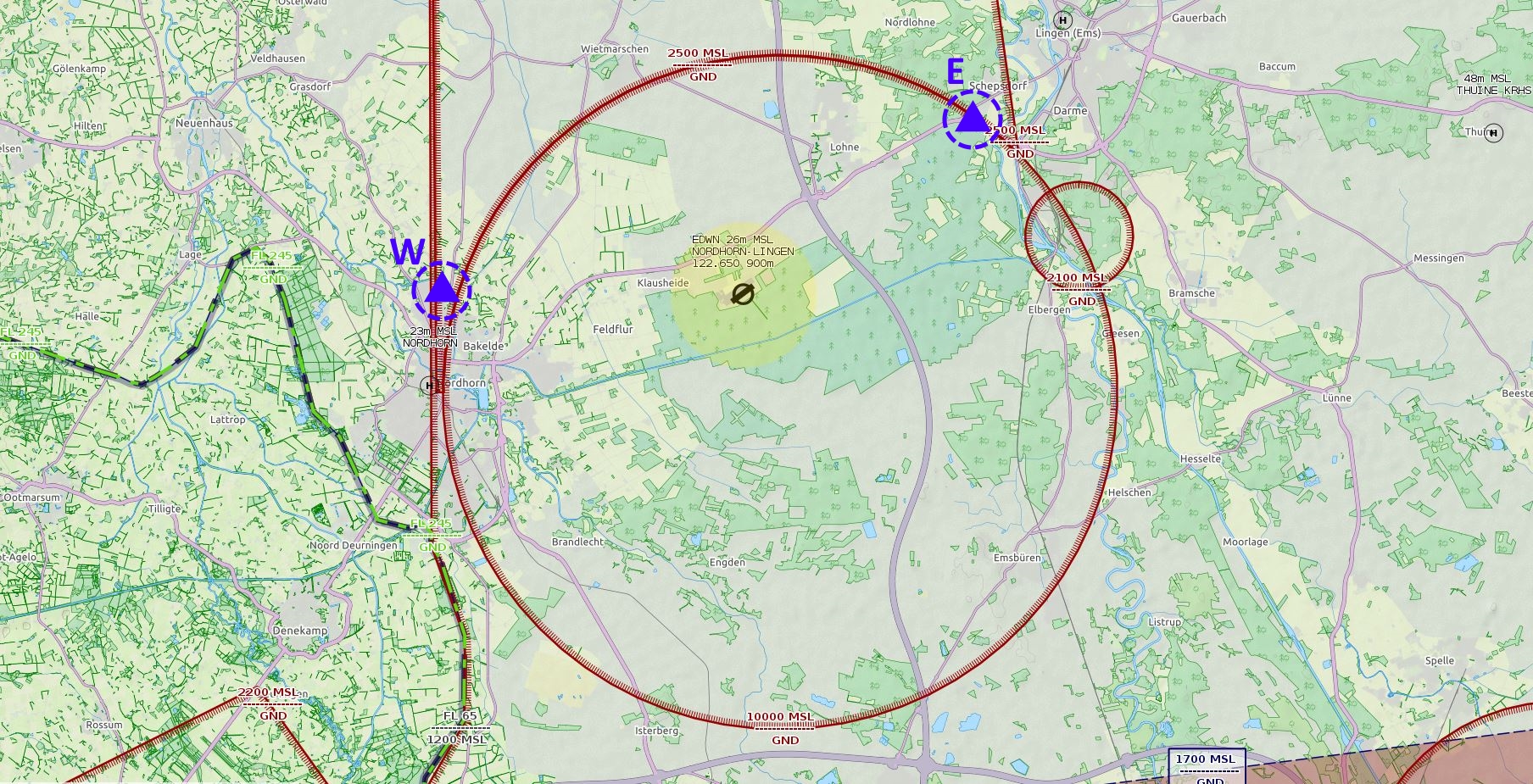
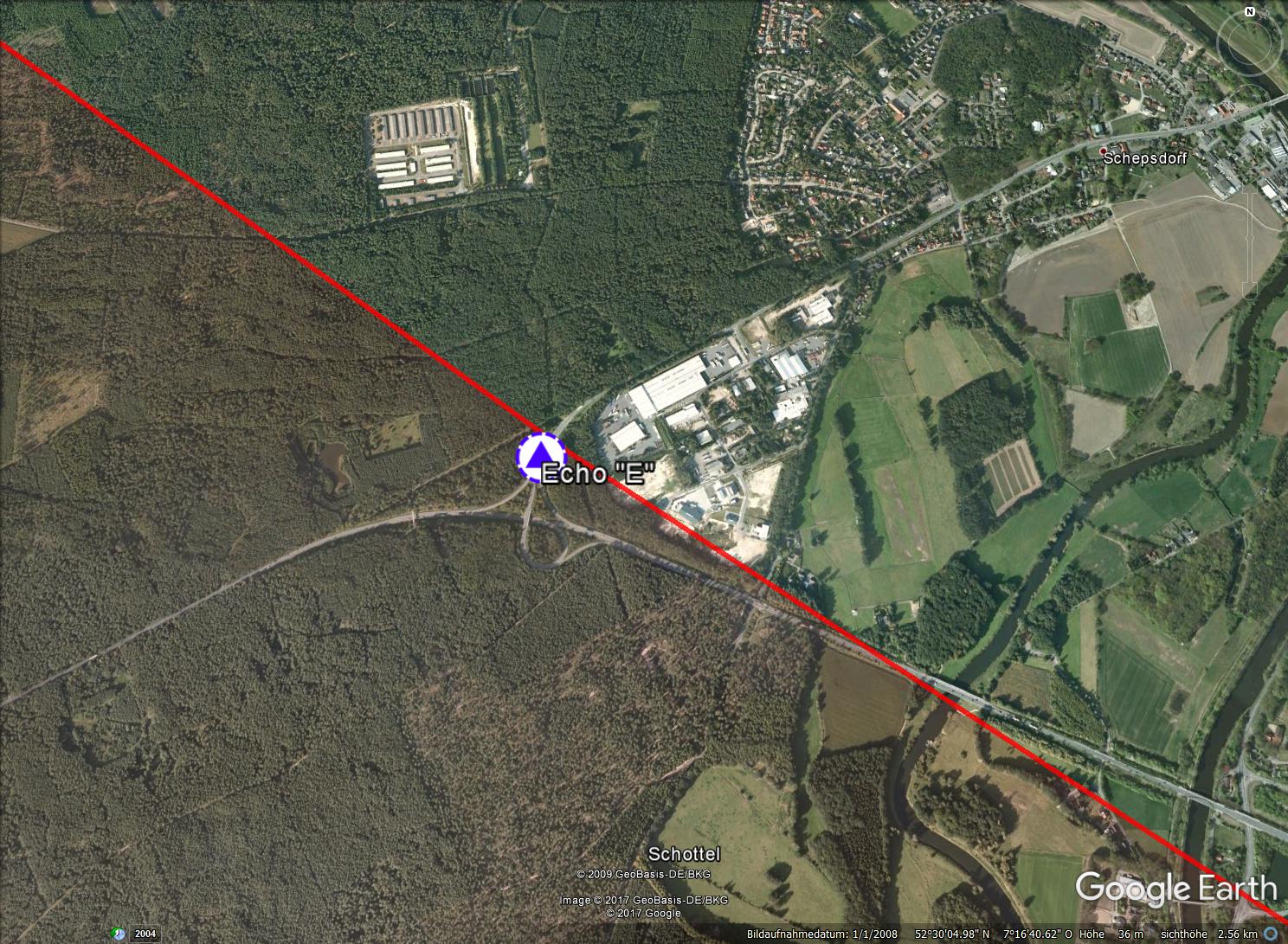
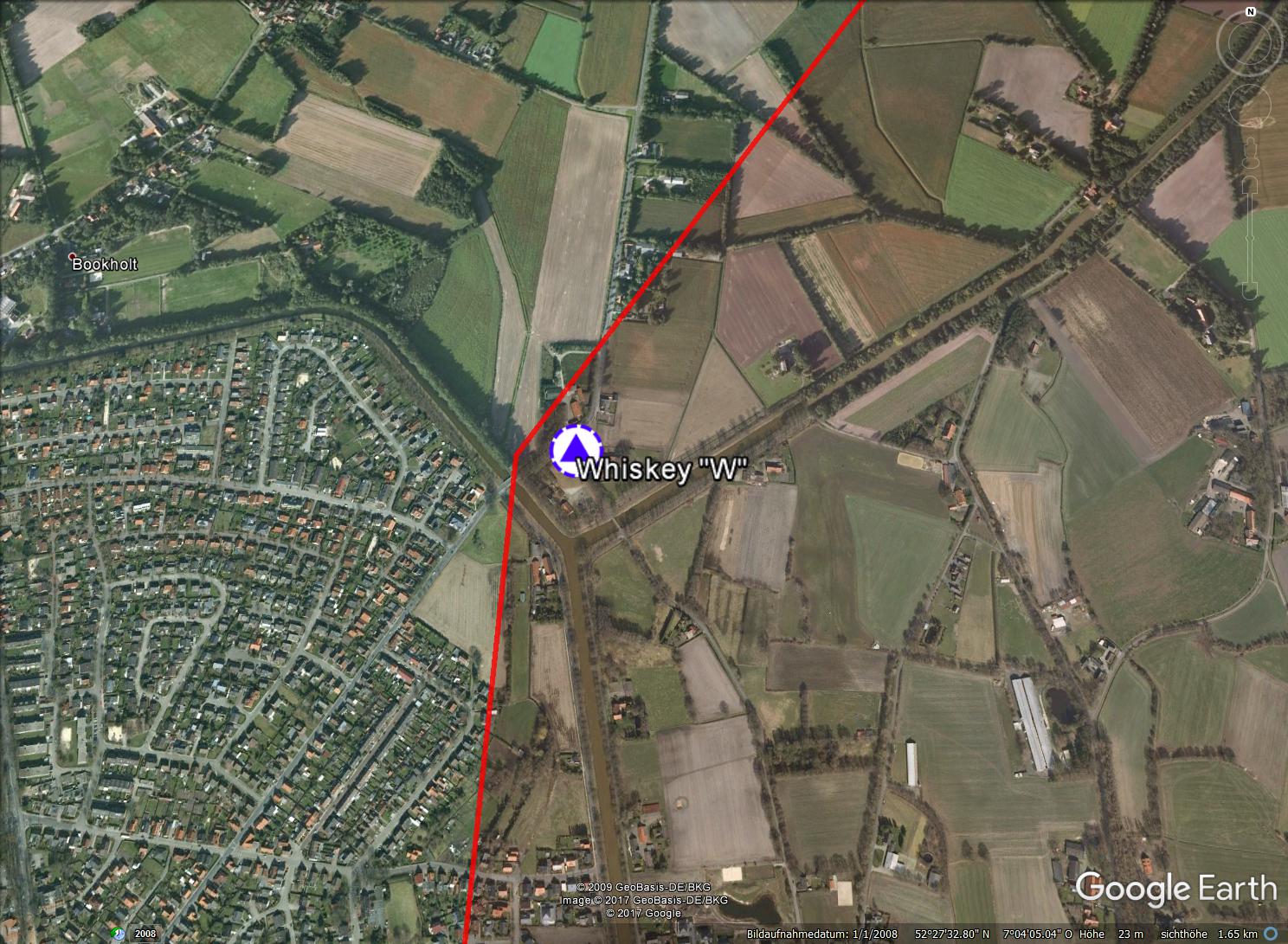
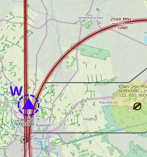
ED-R 37A

Don’t worry
about the restricted flying area!

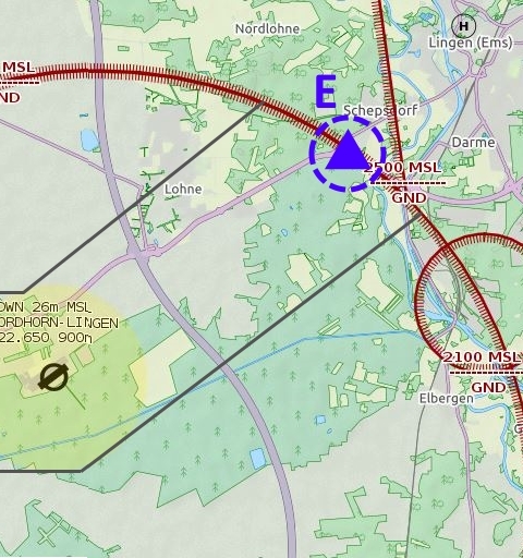
The mandatory reporting points and the arrival / departure procedures do not apply if the restriction flying area ED-R 37A is deactivated.

You can check the status of the ED-R 37A at any time during the flight on Nordhorn-Info 122.655 MHz, or before the flight by calling +49 5921 36733.
When ED-R 37A applies, arrivals and departures are communicated to and discussed directly with the German Army's Range Control Officer (RCO) directly from the Nordhorn-Lingen aerodrome. From this moment on, the Nordhorn-Lingen aerodrome becomes a controlled space. If the flight restriction area ED-R 37A is activated, only straight-in landing approaches are permitted.
Take-offs and landings, Approaches/Departures MAX 600 MSL

Download the Google Earth file here and check it out in your own time:     EDWN_EDR37.kml

Overview map


Reporting point "W"


Whiskey "W" befindet sich im nord-östlichsten Bereich von Nordhorn-Bookholt, dort, wo der Ems-Vechte-Kanal und der Süd-Nord-Kanal ein Kanal-Dreieck bilden.

Reporting point "E"


Echo "E" befindet sich im süd-westlichsten Bereich von Lingen-Schepsdorf, dort, wo die Abfahrt der B213 zur L60 verläuft. Gut aus der Luft zu erkennen ist das anliegende Industriegebiet.


Corridor "West"


Anflug:    093°   |   Abflug:    273°

An-/Abflüge, Approaches/Departures MAX 600 MSL

Terrestrial features of the "West Corridor" include the B213 main road (Bundesstrasse) and the Ems-Vechte Canal.

Corridor "East / Ost"


Anflug:    232°   |   Abflug:    052°

An-/Abflüge, Approaches/Departures MAX 600 MSL

Terrestrial features of the "East Corridor" include the B213 main road (Bundesstrasse) and the Ems-Vechte Canal.

Data used comes from openAIP. Visit openAIP.net and contribute to better aviation data, free for everyone to use and share. http://www.openaip.net/